Out of Alaska

img_16971.jpg

All told, we spent ten days exploring Alaska, and as I’ve alluded to before, were able to see only a small fraction of the enormous state.  We did other things while we were there that I have not chronicled in the blog, since they weren’t specifically outdoor related – after all, this is a blog about outdoor explorations, not a broader travel blog – though they were also exciting parts of the trip.

When we first began looking into planning our Alaska trip, which had been on our list of places to visit for many years, most of what we found discouraged forging your own way, as we did.  Recommended ways to see Alaska usually included cruise ships or other, similarly proscribed methods.  While those may be easier, I think that we were able to see more of substance during our Alaska vacation by going our own way.  Of course, we tend to be in favor of controlling our own courses and avoiding crowds, anyway, so that might have had something to do with it.

IMG_9756

I have every intention of returning to Alaska at some point.  There is so much more to see; we never even began to venture into the more northern regions of the state, completed skipped the capitol, and didn’t venture to the islands.  Since we went in the summer, we had a great experience with the midnight sun, but I would like to see it in the winter, when the night is eternal, not least because of the fantastic opportunities to see the northern lights.  Of all the places that I’ve visited, Alaska would be one that I would consider making a permanent residence.

Hopefully you’ve enjoyed reading these Alaskan posts.  Now that there’s no further trip to chronicle, I’ll be returning to our previous mixture of instructional posts, techniques, and posts about smaller scale adventures.  I hope that you’ll continue to partake of the experiences I have to share.

This slideshow requires JavaScript.

Along the Park Road

IMG_1118

I maintain that the best way to experience Denali is to stop the bus, get off, and go hiking, preferably for several days at a time.  However, with the vast scale of the park, I am forced to admit that the best way to see Denali is to stay aboard one of the buses and take it as deep into the park as you can go.  It will probably mean spending eight hours on what is little more than a school bus, but doing so will allow you to pass through many of the varied terrains and environments that Denali has to offer, and you’ll probably see more wildlife than you would while hiking, simply by virtue of covering a greater distance.

With my family still weary from our long, challenging day hike the previous day, we did just that: parked ourselves on a bus and allowed the driver to take us through the expanse of wilderness that is Denali.  It was a long day of sitting, but well worth it.  We were able to see moose, bears, foxes, ptarmigans, mountain goats, caribou, and other creatures, not to mention the grand vistas and impressive facades of the less animate scenery.

There’s really not a lot that I can say about the bus ride that won’t be better conveyed through the pictures.  After all, it was simply sitting on a bus.  It is worth noting how much the climate changed as we ventured deeper into the park.  It was sixties and sunny when we started, and at the far end of the ride, it was thirties and snowing.  That’s unusual for June, but not unheard of. I highly encourage you to scroll through the pictures and see just what we were able to see on the Denali bus ride.

This slideshow requires JavaScript.

A Day in Denali

IMG_0881

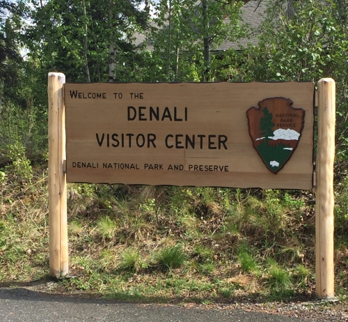
Denali, which translates roughly to “Great One,” is the name of both the tallest mountain in North America, and one of the most well-known Alaskan national parks, although Denali National Park is not the largest national park.  Following our time in Sutton, we ventured north, deeper into the state, to Denali National Park, which would serve as the location for our next series of adventures in America’s last frontier.  To start off our time in Denali, we set out on what I consider to take the number three spot on our Alaska trip: a full day hike off trail in Denali.

IMG_0982

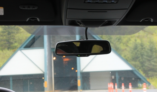
Somewhat unique among national parks, there are very few trails at Denali, mostly concentrated around the few visitor centers, and none of them are extensive.  There is also only one road, and private vehicles aren’t allowed.  To really see Denali, you’ll need to purchase bus tickets to get out along the park road.  From there, you have two options: sit on the bus for up to eleven hours, following the park road and seeing what there is to see that way, or getting off to hike.  You can ask these buses to stop at any time so that you can get off and hike, and then you just have to pick up any bus when you get back to the park road.

IMG_0969

We did the whole sit on the bus for hours thing, but that was our second day in Denali.  For our first day, we did what I had been looking forward to since I started planning our Denali hike: a full day of hiking, off trail, in Denali.  We boarded the earliest bus into the park, at 0500, and ventured forth.  Our bus driver had a dry sense of humor and a monotonous voice, leading my family to christen him “Batman.”  When we stopped the bus around 0645 to get off to hike, his announcement to the other passengers was “they are going to join the food chain.”  There were a lot of strange looks as we stepped off the bus and into the waiting forest.

IMG_0931

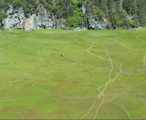
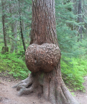
I was aiming us for a low pass between two peaks: the idea was to go over the pass, and wind back around to the river, where we could re-join the park road after about ten miles of hiking.  As with most plans, this one didn’t quite work out, but we had quite the adventure, nonetheless.  To reach the pass, we first had to pass through a pine forest.  There was a layer of loam covering the forest floor nearly a foot thick in most places: I compare it to a sort of terrestrial coral, with a layer of living moss and plant material growing atop a thick base of skeletal plant material.  There was ample evidence of moose and caribou, and even some of bears, in the area, but we saw no such impressive wildlife on our hike.

After passing by a few mountain lakes, we began to make our way up the first part of the pass.  Reaching the top, with its prevailing winds, was a relief, as the breeze helped dispel the swarming mosquitoes.  Denali mosquitoes are large and numerous, but they seemed to not know quite what to do with us: for the number of mosquitoes we saw, we received very few bites.  Although it was only 1000, we decided to have the first of our two sandwiches at that point: after all, we had been up since 0400.

As we were eating our second breakfast, in the manner of good hobbits everywhere, the wind started to pick up, and we noticed rain blowing into our area.  It is commonly acknowledged that it’s always raining somewhere in Denali, and it seemed that it would soon be our turn.  We decided that rather than continue up the pass, we would descend along the other side of the hill on which we stood, and make our way through a valley we saw until we reached the river.  It was a fateful decision.

IMG_0953

What the topographical map we purchased before setting out failed to convey was that the valley, which depicted a stream, was in reality an extensive marsh.  I have to say, my Zamberlan boots proved to be worth the money I spent on them, allowing me to traverse the marsh without getting my feet wet, but my companions were not so fortunate.  Between the rain that started to dampen us from above, and the marsh dampening us from below, there was a considerable dampening of spirits as we tromped our way through the valley.  It didn’t help that my family was admittedly not quite so enthusiastic about the whole off-trail hiking experience as I was.

With the weather seeming likely to remain less than ideal, and the marsh having bogged down what enthusiasm there had been, the decision was made to arrow through another pass that would take us more quickly back to the road.  Traversing the marsh had reduced out speed to a crawl, so although it had been two hours since we had our second breakfast, we had covered a distressingly minute distance.  At our pace, it would have taken into the dinner hour to reach the road, if we tried to attain our originally intended access point.

IMG_0972

Leaving the marsh behind was a relief all around, although the pass we chose was steep and dense with brush in places.  After achieving the top of the pass, we caught a glimpse of the park road, given away by a bus winding along it in the distance, which helped to rejuvenate the flagging spirits of my family members.  We made much better time in our descent, following natural trails we found winding through the forest, and around 1415, we successfully returned to the park road.  Before long, we had caught a ride on a bus, and were on our way back to civilization.

The rest of my family would probably disagree about this hike taking the number three spot, and it probably doesn’t do wonders for my credibility on this blog that I can’t convince my own family of the magic inherent to off-trail hikes like this.  To me, there is something uniquely exciting about hiking like that, and I have every intention of one day returning to Denali to backpack into the more remote areas of the park.

This slideshow requires JavaScript.

An Icy Reception

IMG_0772

Between the Seward boat tour that started out our Alaska trip, and the bear viewing flight I discussed in the previous post, all other activities really were relegated to vying for third place. Certainly our glacier hike we took our first morning in Sutton was an interesting experience, but compared to what we’d already done, it was somewhat lackluster. Admittedly, the idea of walking on a glacier had been consistently hyped in the literature we reviewed before departure, and the experience itself proved to be a bit oversold. However, it did afford some excellent pictures, and an opportunity for us to delve further into glacial science.

I provided a brief introduction to glacial science in our post about Exit Glacier, which we visited early on in our Alaska trip, but entire volumes could be written about glaciers, and, indeed, have been written.  Far more than imposing piles of ice, glaciers are ecosystems in and of themselves.  They create their own microclimates, sculpt landscapes, alter sea levels, and at one point in time covered the entire surface of the planet, a time called “snowball earth.”  Scientists, it has been observed, have a penchant for creative naming conventions.

IMG_0753

Drinking pure glacier water

Like icebergs, hippopotamuses, and crocodiles, there is a great deal more to a glacier than what is readily apparent.  In most cases, you’re able to see only a tiny fraction of the entire structure, which will stretch far up into the mountains, and even below the ground.  We were for some time walking on a glacier without even realizing it, because it was so covered in glacial till – also known as gravel and dirt.  The glacier we were on, if you reference the pictures, was actually more than three hundred feet thick.  Mulans led straight from the surface all the way to the bedrock.

Since this is an outdoors blog, not a science blog, I should probably spend some time expounding on topics other than glacial science.  Therefore, let’s talk a bit about crampons.  If you’re not already familiar, crampons are a mountain climbing tool that are strapped to your normal boots, and consist of a series of metal teeth oriented to dig into the ice and facilitate climbing on treacherous surfaces.  Our guides were very keen on formal “crampon technique,” but I found that such a rigid methodology was unnecessary.  For me, it was sufficient to be aware of the crampons as I walked.

Don’t allow me to discourage you; walking on a glacier really was an interesting and unique experience.  It simply wasn’t sufficient to fight it’s way into the top three for our fantastic Alaska trip.  And if you’re wondering what did achieve the number three position, you’ll have to keep watching the blog: it will be coming up soon.

This slideshow requires JavaScript.

Bear Viewing

img_0586.jpg

We had some amazing experiences on our Alaskan trip, especially when it came to wildlife.  The boat tour in Seward was a spectacular way to start the trip, and later on, when we got to Denali, we saw roaming moose and other wildlife, and of course there were so many amazing non-wildlife related activities.  Come the end of the trip, however, there was one that really stood out, and that we unanimously decided was the definite highlight of the trip.  In some ways, it was a lesson in you-get-what-you-pay-for, because this was by no means an inexpensive proposition, but our bear viewing flight tour was definitely worth the cost.

IMG_0598

Our tour was courtesy of Alaska Air Service, and started out of Merrill Field, in Anchorage.  After a pre-flight briefing, we loaded up into a small prop plane, described to us as the “suburban of small aircraft,” and took off, headings towards Lake Clark National Park.  The flight itself offered gorgeous views of the mountains and other terrain; we flew between mountains and up through a pass where everything was entirely covered in snow, and around volcanoes, on the way to our first bear viewing stop.  It also presented new insight on life in Alaska, since we could see the various fishing shacks, local power plants, and other facilities, all of which could only be reached by boat or small plane.  We saw no roads or human trails as we flew: any trails we saw were animal highways.

IMG_0611

Reaching Lake Clark National Park, we landed on a gravel beach, sans formal runway, and began making our way inland, towards a long field of grass, with a river running through it.  This, our guide and pilot explained, served as a natural gathering place for bears, who were attracted to the plentiful fresh water and food.  He had explained in advance that there was never any guarantee that we’d see bears, but that by knowing their habits and customs, he could usually make a good guess as to where they might be.  Good guess might be a bit of an understatement, because when we emerged from the shelter of the trees to the edge of this elongated meadow, we saw a bear digging for roots less than thirty feet away from us.

Bears have kind of a poor reputation, in that people seem to think that they will simply attack without provocation.  This is a sad mischaracterization: bears, like most animals, would prefer to avoid interaction with humans under most conditions.  They only become dangerous under a few conditions.  If something is wrong with the bear, then it can behave unpredictably.  If the bear has cubs, then it will behave aggressively in defense of them.  If the human acts like prey (runs away or gives off signals of fear or panic), then the bear will assume that the human is prey, and respond accordingly.  Finally, many bears seen near park visitor centers and other places where humans frequent might come to associate humans with easy food.  In the wild, though, where the bears have had no real exposure to or interaction with humans, the bears will usually ignore people.  To the bear, we were just part of the environment, unless we did something to make ourselves otherwise.

IMG_0651

By reading the signals from the bear (how often did it look up at us, how content was it to continue eating, what direction was it moving, how was it standing, and so forth), you can tell what the bear is thinking of you and if it’s likely to become a threat.  As long as the bear didn’t seem to be too curious, we were able to stay right where we were.  When it started to look at us more frequently, we backed slowly a little distance away, and it returned to ignoring us completely.

For several hours, we perambulated up and down the beach at our first landing sight, finding various points to penetrate the barrier of trees that separated the beach from the meadow and river, and each time we saw more bears.  By the time we had walked back and forth along the length of the beach several times, we had seen probably close to two dozen bears, at varying distances.  We could probably have continued to see them if we’d stayed longer, but we eventually decided to return to the plane and try our luck at the next sight.

IMG_0682

Luck turned out not to be with us for the next site.  It was very windy, and our guide explained that the bears tend to avoid windy areas, since it confuses their sense of smell.  Think of it like standing in one of those mirror mazes.  So our second sight visit wound up involving more of a leisurely stroll along another river and meadow, and a break for a late lunch (which was included as part of the tour).  After we’d made our way around in a wide loop, we returned to the airplane, and it was time to becoming acquainted once again with the spectacular views we experiences on the flight into Lake Clark.

The tour as a whole lasted from about 0900 to about 1630, making for a full day.  When we got back, it was time to find dinner and make our way to our next base of operations, in Sutton.  Even at that point in the trip, we knew that our experiences that day were going to be very, very hard to top.

This slideshow requires JavaScript.

Alaska Wildlife Conservation Center

As I said when I started this series of posts about our adventures in Alaska, not every post is going to be about hiking or camping, as has been the case in cataloging many of my other adventures.  The fact that I haven’t sold the rest of my family on backpacking, despite writing a blog on the topic, probably doesn’t do wonders for my credibility, but the brand of vacation we undertook in Alaska did have the advantage of allowing us to see much more of the state than we otherwise might have been able to see.  As much as it would have been amazing to spend ten days backpacking Denali National Park, that would have inhibited the amazing experiences that we had in Seward, Whittier, Girdwood, Anchorage, and the other cities and towns through which we passed.  Even the way we did it, we saw only a tiny portion of Alaska.

The point of all that is to say that, if you’re bored by posts like this one, which is going to walk through the Alaska Wildlife Conservation Center, you can feel free to pass over them.  Don’t worry: once I’ve finished regaling you with all of the stories from Alaska, the blog will be getting back to instructional posts, and descriptions of more focused explorations.  For now, though, I hope that you’ll continue to enjoy reading about the plethora of unique sights and experiences in Alaska.

IMG_0456

Our next stop was the Alaska Wildlife Conservation Center.  It’s a sort of weird cross between a zoo and a farm, though neither of those descriptors really achieves encapsulation of the objectives of the AWCC.  Unlike either of those institutions, the AWCC collects native Alaska animals that are injured or cannot survive in their natural habitats, and gives them a place to live at the center.  North American porcupines, moose, black bears, brown bears, various deer, elk, caribou, musk oxen, and wood bison all have a place at the AWCC.

It’s certainly not the same as seeing wildlife in its natural environment.  Coming across a bear, moose, or other animal on the trail, on equal footing, if you will, is a very unique and special experience that cannot be replicated in a forced manner.  However, a conversation center like this one does present the opportunity to get a view of these animals that you’ll likely never get on the trail, and since you can never be certain of a “free-form” wildlife encounter, you can be sure that you’ll get to see the creatures you’re hoping to see.

IMG_0484

Let’s talk a little bit about wood bison.  It turns out that there were once herds of wood bison roaming the northern forests of Alaska and Canada.  They grew slightly larger than their plains brethren, and tended to roam in smaller herds.  However, they were driven extinct, and for many years, were known only in memory.  The AWCC helped lead an effort to resurrect this ancient creatures.  By importing plains bison and breeding them in the Alaska environment, they were able to slowly form a herd of wood bison at the conservation center (plains bison and wood bison are not genetically different species).  When it was deemed sufficiently large and genetically diverse, the herd was flown by bush plane to a remote part of Alaska – hundreds of these animals, weighing hundreds of pounds each – and released.  Several herds of wood bison continue to thrive in Alaska, thanks to the daunting task undertaken by the AWCC and its partners.

We didn’t spend long at the AWCC, and after that, it was time to make our next move.  Our next destination was Sutton, Alaska, but we had a very important stop to make first, in Anchorage.  This next activity was probably the highlight of the entire trip, so I hope that you’ll come read about that.

This slideshow requires JavaScript.

Bridges? How Dull.

IMG_0434

For our second day of operations out of Girdwood, we made use of a trail located mere steps from our temporary place of residence. Although the Winner Creek Trail does not directly connect to where we were, we were able to take an easily accessible spur to join up with the trail proper. There was some initial confusion, since part of the spur had the appearance of a sidewalk, but once that was resolved, the trail was straightforward (figuratively, not literally).

This was another trail in a temperate rain forest sort of environment. Mostly, it was composed of black, granite gravel. Where this coating was not present, boardwalks had usually been erected, since these regions tended to be exceedingly muddy. Although there is some up and down, Winner Creek Trail is pretty easy: I would be very comfortable running it at speed.

img_04431.jpg

Besides being so local, which is always a benefit, Winner Creek Trail offers views of some impressive burl (you can read more about burl in the Redwoods post, although these trees were not redwoods), enormous granite boulders, and a rushing river. The water of this river is so aerated that it has a brilliant blue color that you don’t commonly see. If you don’t feel the terrestrial perspective is sufficient for your view of the river, you can take advantage of one of the more unique parts of this trail: the hand tram.

IMG_0409

When I was told that the Winner Creek Trail had a hand tram, I was envisioning one of those old fashioned railway cars, where one person stands on one side of the lever, and another person stands on the other side of the lever, and with a sort of sea-saw motion, you propel the vehicle along the track. In reality, the hand tram was more like a slow motion zip line. You step into a green cage, which is suspended from a wire, and draw yourself along by a rope (you can also have your companions on the platform haul for you). It’s the only way to get to the other side from that location (though you don’t have to cross in order to complete the trail), and offers some unique views of the gorge. I wouldn’t say the hand tram is reason enough to do the trail, but it is a rather unique feature.

This is an out and back trail, not a loop, so after we ventured forth on the hand tram, we ventured back the way we had come, along the boardwalks, past the avalanche scar, and back to our Girdwood base of operations. Winner Creek Trail would be a great hike for less experienced hikers to get a glimpse of Alaska’s natural grandeur, and offers a pleasant morning stroll for more experienced adventurers. If you’re in the area, consider checking out Winner Creek Trail.

This slideshow requires JavaScript.


Selene in the Land of the Midnight Sun

It never actually got dark while we were in Alaska.  Oh, there were sunset and sunrise times: officially, the sun set at about 0030 (12:30 at night), and rose around 0330, but it never actually got dark, even when the sun was “down.”  (Of course, this situation is reversed in the winter, with a mere three to four hours of “light”).  The effect was a little disorienting, but after a few days, I mostly grew accustomed to it.  There was something peculiarly thrilling about being able to check the weather on a cloudy day and say “hey, the sun is going to come out at 2300.”

IMG_0346

Despite the decided dearth of night, we were still able to observe some interesting lunar effects (the moon is called Selene in certain astronomical circles), particularly in the form of bore tides up Turnagain Arm (part of the Cook Inlet).  We had some difficulty finding, and then identifying, the bore tide, but once we had positive confirmation that what we were seeing was, in fact, the bore tide, it was an interesting sight.  Not so interesting, however, that we felt the need to do as we saw one soul doing – he was attempting to surf the bore tide (this is apparently a bit of a Thing in Alaska).

Put simply, a bore tide is when the incoming tide runs counter to the typical direction of current in a certain region, creating one or more, sometimes significant, waves.  Bore tides are not uncommon, but bores significant enough to be visible are: there are only a few locations in the world where bores are consistently large enough to be clearly visible.  The more extreme the tides, the more pronounced will be the bore tide, so the size of a bore tidal wave will vary depending on the spread between the high and low tides.

IMG_0347

We estimated that the bore tide we viewed was about eight inches high – a sign mentioned that the bore tides for that place could range from six inches to six feet in total height.  Apparently, the bore tides in Turnagain Arm used to be more impressive, before the 1964 earthquake altered the seafloor.  After spotting it at the first viewing location, we drove along to see it from another location at a narrower point, where the tide would be more pronounced.  You can time the bore tide viewing: they usually roll in about fifteen to twenty minutes after low tide.  The magnitude of the tidal differential affects the extent of the bore tide, which can move at almost twenty miles an hour down Turnagain Arm.  There’s a whole science around predicting when the largest bore tides will be, but even a normal one is interesting in its own right.

Maybe bore tides aren’t the most exciting thing in the world – I certainly wouldn’t say that it’s a prime reason for you to make your way to Alaska – but it was an interesting phenomenon to observe, and more significant than we expected it to be.  As more for the adventure of finding and identifying the tie, this was a worthwhile experience, and I would encourage you to find a chance to see the bore tide if you’re in the Turnagain Arm area.

Through the Portal…

Our stay in Seward was an amazing start to the trip, thanks to the spectacular wildlife encounters of our first day’s boat tour, and the dramatic vistas offered by our Harding Ice Field and Exit Glacier hikes, but since Alaska is such an enormous state, in order to see even a tiny portion of it we had to move on after those two days.  For the next part of our trip, we stayed in Girdwood, which during the winter is a ski resort town, but during the summer becomes quiet (and discounted).  From our base in Girdwood, we proceeded to the little town of Whittier for a boat tour of local glaciers.

img_0244-e1530054637379.jpg

The tunnel into Whittier

Positioned as it is, Whittier can only be accessed by land through a narrow tunnel bored through the solid granite of the mountain.  It is only one lane, and serves the train, as well, so it is only open to vehicular traffic from a given direction every half an hour or so.  There is a small fee to use the tunnel as you go towards Whittier, but you won’t have to pay again on the way back.  As with many accomplishments, this tunnel was originally constructed for the US Army.

While the Army maintained its base in Whittier, through World War II and much of the Cold War, Whittier had a population of about 1,600.  Today, it has a population of about 250, all of who live in one of two apartment buildings that look very much like they were built in the fifties and sixties, which they were.  The only other major edifice in the town is the former Army building, a sprawling, unpainted, reinforced concrete structure that no one has done anything with; between the asbestos and the building’s bomb-proof nature, it would cost millions of dollars to demolish or re-purpose.  It looms in eerie fashion from the far end of the little town of Whittier.

IMG_0309

One of the apartment buildings. You can see most of the town in this image.

If it weren’t for the cruise ships that stop by Whittier’s port, I am convinced that the town would have no knowledge of 21st century happenings, like the internet.  Passing through the tunnel and emerging on the Whittier side was like passing through a portal, a wormhole back through time.  It isn’t so much that time stands still in Whittier – it’s more that time simply forgot about the little town.  Even the weather was different when we passed through the tunnel, going from a brightening sky to gloom and rain and brooding clouds.

There is a little museum connected to a motel and general store in Whittier, and when I say little, I mean that unless you live in a cardboard box, your bedroom is probably bigger than this museum.  Despite its diminutive size, however, it did have some interesting history to convey, history that has generally been neglected, overlooked, or perhaps intentionally ignored by most textbooks, museums, and historians.  It turns out that in the early days of World War II, several of the Alaskan islands were occupied by the Japanese, their occupants imprisoned, with many of them being sent to Japan.  Only after months and several, very bloody battles were these islands reclaimed by American forces.  These tales were a sobering reminder of just how dark and uncertain things looked for the Allies in the opening days of the second world war.

IMG_0256

Those are seagulls.  When threatened, they all swarm off the cliff in a swirling mass to try to protect their young.

However, we didn’t come to Whittier exclusively for their one-room history museum.  The main reason for our visit was a glacier tour, courtesy of Major Marine Tours.  There were wildlife viewing opportunities as well, such as seagull (I’m sorry, black-legged kitty wakes) tornadoes, and the glaciers were certainly impressive, but the whole experience was, through no fault of the tour, somewhat anticlimactic.  After our previous experience with our boat tour in Seward, this much larger, more impersonal voyage simply couldn’t compete.

Our Major Marine tour took most of the afternoon, but we decided to have our dinner in Whittier before heading for the tunnel and making our way back to Girdwood.  We ate at the Swiftwater Seafood Cafe, (called Swiftwater Seafoods Restaurant on TripAdvisor).  It might be the most expensive “fast food” you’ll ever have, but it was excellent food.  I highly recommend that red chowder, which has an unusually high concentration of seafood.

We made it safely back through the portal before it closed for the evening, and returned to our base in Girdwood.  Look for our next post, about our adventures on the Winner Creek Trail and the use of a hand tram.

This slideshow requires JavaScript.

Exit Glacier

IMG_0235

As mentioned in out last post about the Harding Ice Field Trail, if we had done the entire trail, we would have been afforded some spectacular views of Exit Glacier.  However, we didn’t do the entire trail, so in order to see the glacier, we took a different, much shorter trail, more of a walk than a hike, to see this enormous, and ancient, pile of ice.  Although growing up we liked to call the pile of snow that the plow deposited at the base of our driveway a glacier, that is nothing compared to a real glacier.

IMG_0223

I think it is worth taking a brief digression to discuss glacial science.  A glacier is nothing more than snow and ice that has been compressed into a much denser form.  In natural cases, this is accomplished from snow piling atop snow year after year, without melting away during the summer months.  After about ten years, there will be a sufficient mass of snow on top of the first year’s snow to compress that first year’s snow into glacial ice.  It is this process of compression that lends a glacier its blue color; when the snow is compressed to such an extent, the space between the molecules of dihydrogen monoxide (water) is reduced, so that only shorter wavelengths of light, like blue, can pass through.  This is also why icebergs, which are made of glacial ice, ride so low in the water – glacial ice is tangibly heavier than a comparable amount of regular ice, and also takes longer to melt.

IMG_0228

There’s far more that we could talk about when it comes to glacial science, and more that we probably will talk about, since one of our activities later on in the trip involved hiking on a glacier, but for now, let’s focus on Exit Glacier and our experience with this particular, ultra-dense mountain of ice.  The trail we took leading up to Exit Glacier followed the path of the glacier’s regression, estimated back to the glacier’s peak extent during the latest “mini ice age” in the early 1800s.  That means we were walking on a moraine, which is a fancy word for what is essentially glacial dirt.  All of the measurements were estimates made based on a 2007 investigation.

We were only able to get to within a few hundred yards of the glacier, so it was difficult to get a sense of the scale of the facade with which it presented us.  It tapered off to what looked like a little tip between some boulders, but accounting for distance and the distortions of magnitude, we suspect that the “little tip,” which appeared to be about six feet tall,  probably towered somewhere between thirty five and fifty feet tall.  If you have trouble visualizing a measurement like that, call it six to ten persons tall.

Glaciers have been a hugely powerful force in shaping the geography of our world, and the full range of their continued influence on the environment is still being discerned.  Whatever their role in the grand cycles of the planet, seeing a glacier like this was an awesome experience, in the oldest sense of the word.

This slideshow requires JavaScript.